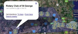
I was intrigued with the way that various people have used Google Maps to present information – particularly real estate agents. It is possible to search for a home with attributes like price, rooms, and the like and be presented with a map with icons representing the home in a map. It seems the professional users use databases like MySQL, but it is also possible to use a link from Google Spreadsheets, though the data, which could involve fields that are private, are open for all to see. My first attempt was to show the Rotary Clubs in District 9630 (SE Queensland) on a map. The information is available from the Rotary International website, but not in an easy to use form.

What I did was to use Google Maps to locate on a map the venue for each club, then edit that to give the meeting times and day for each club. I also downloaded a Rotary International logo as a PostScript file and made it smaller with Adobe Illustrator 10. I saved the small GIF file on my Rotary Club’s web site.
I also overlaid a graphic of the boundaries of District 9630 onto Google Earth, adjusted its transparency and exported the whole lot to Google Maps. From there I was able to export a Google Map as a link that could be e-mailed or as HTML that I pasted in maps.dbohs.com
It seems to work fine, but the information is static. As I work out what MySQL and PHP is all about, I will develop a more elaborate version…
DB
